By Myles Traphagen, Borderland Programs Coordinator, Wildlands Network
Sacramento, California was the location of the tenth biennial International Conference on Ecology and Transportation (ICOET) held September 22 to 26th, 2019. Jessica Moreno, the Coalition for Sonoran Desert Protection’s Conservation Science Director, presented the “Safe Passages for Wildlife on Interstate-10 within the Rincon-Santa Rita-Whetstone Mountains Wildlife Linkage” project, made possible by a generous grant from the Arizona Game and Fish Department Heritage Fund.
Nearly 600 delegates from 19 countries attended the four-day conference held at the Hyatt Regency directly across the street from the California State Capitol building. The vast array of topics at the conference ranged from camera trapping workshops, wildlife crossing structure design, public policy, and the state of transportation ecology around the globe.
With nearly 4 million miles of roads in the United States, and the ever-increasing paving of new roads globally (estimated to total 16 million miles by 2050), the effects of mechanized human transport on wildlife, biodiversity, and highway safety are staggering. The constant, daily stress exerted upon wildlife and biodiversity by roads cannot be ignored. The Coalition for Sonoran Desert Protection is actively addressing this issue through a variety of projects, and the Safe Passages presentation made by Jessica at the ICOET Conference was the final presentation in the Connecting Plans to Action session, for action is our modus operandi.
The 20-mile stretch of Interstate 10 between the Highway 83 and first Benson exit is the focus of our project. It’s obvious to anybody who has driven through this stretch that the numerous drainages and arroyos, like Davidson Canyon and Cienega Creek (which encompass several protected areas and important waters in the eastern Sonoran Desert), provide a natural travel corridor for animals that migrate between the Sky Island mountains north and south of I-10. This area has been a frequent zone of wildlife vehicle collisions. It’s no accident that these unfortunate “accidents” occur, because the Arizona Wildlife Linkages Assessment identified several wildlife corridors that cross right through here. This underscores the perils of the linear infrastructure like roads, railways, power lines and canals that increasingly dominate our modern world.
Now in Phase II, the I-10 Safe Passages project is using wildlife camera monitoring and roadkill surveys, along with community science engagement, to gather species-specific baseline data on wildlife passage rates and roadkill hotspots. We couldn’t do this important work without our dedicated volunteer team of “Desert Roadies” to help us with the driving surveys. Preliminary results, including a black bear mortality on August 23rd at mile marker 289 at Cienega Creek, have already begun to identify optimum locations for wildlife funnel-fencing installation, existing culvert retrofits, and new wildlife crossing structures. These data will inform State and County highway and wildlife officials on where to focus mitigation efforts to improve highway safety and minimize wildlife-vehicle collisions, and to provide justification for project funding.
In the US alone, it is estimated that there are between one and two million large animal wildlife vehicle collisions a year with hundreds of human fatalities as a result. The science of Road Ecology is attempting to reduce these occurrences by using crash analysis and GIS modeling of landscape variables that naturally funnel animals towards point specific places in their daily and seasonal movements. Progress is being made in identifying these places (like along I-10) where the greatest likelihood of wildlife collisions is predicted to occur.
With the data collected from the I-10 Safe Passages Project, we can identify and quantify wildlife vehicle collision hotspots and plan for and modify build-out plans to mitigate and respond accordingly to reduce these conflicts. In the case of the proposed Interstate 11, we support using avoidance and not building it in the first place! In the age of “Super-Commuters,” a term which the Director of the California Department of Fish and Wildlife used to describe drivers who spend two hours each way traveling to and from work, we need to rethink our approach to highway construction and proactively mitigate for and modify the design and building of roads. To learn more about how you can help by volunteering or donating, visit us here. Keep an eye out for wildlife and drive slower, safer and less when you can.
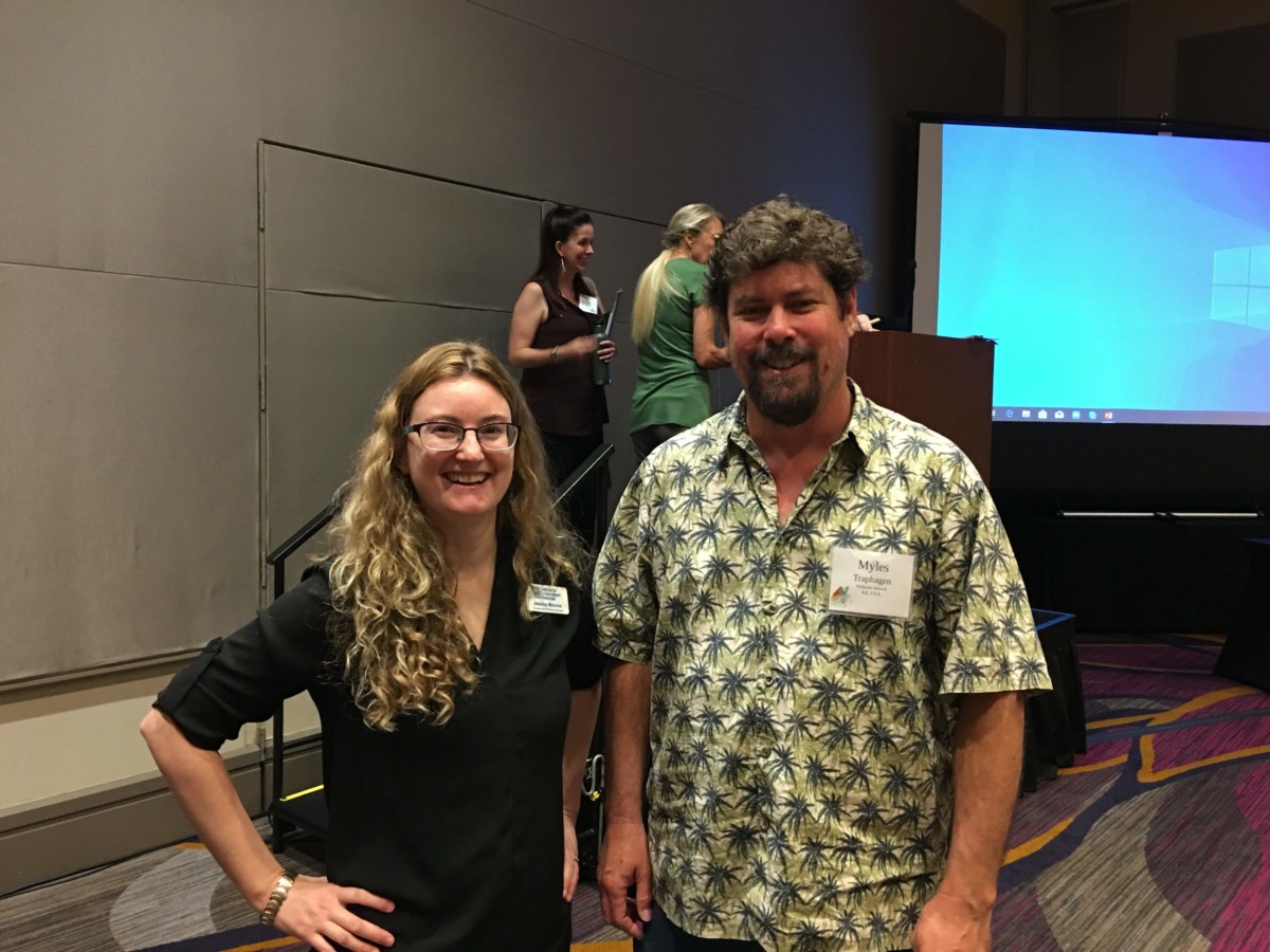
CSDP Conservation Science Director Jessica Moreno and Myles Traphagen, Borderlands Program Coordinator with Coalition member group Wildlands Network, at the International Conference on Ecology and Transportation in Sacramento, CA in September 2019.
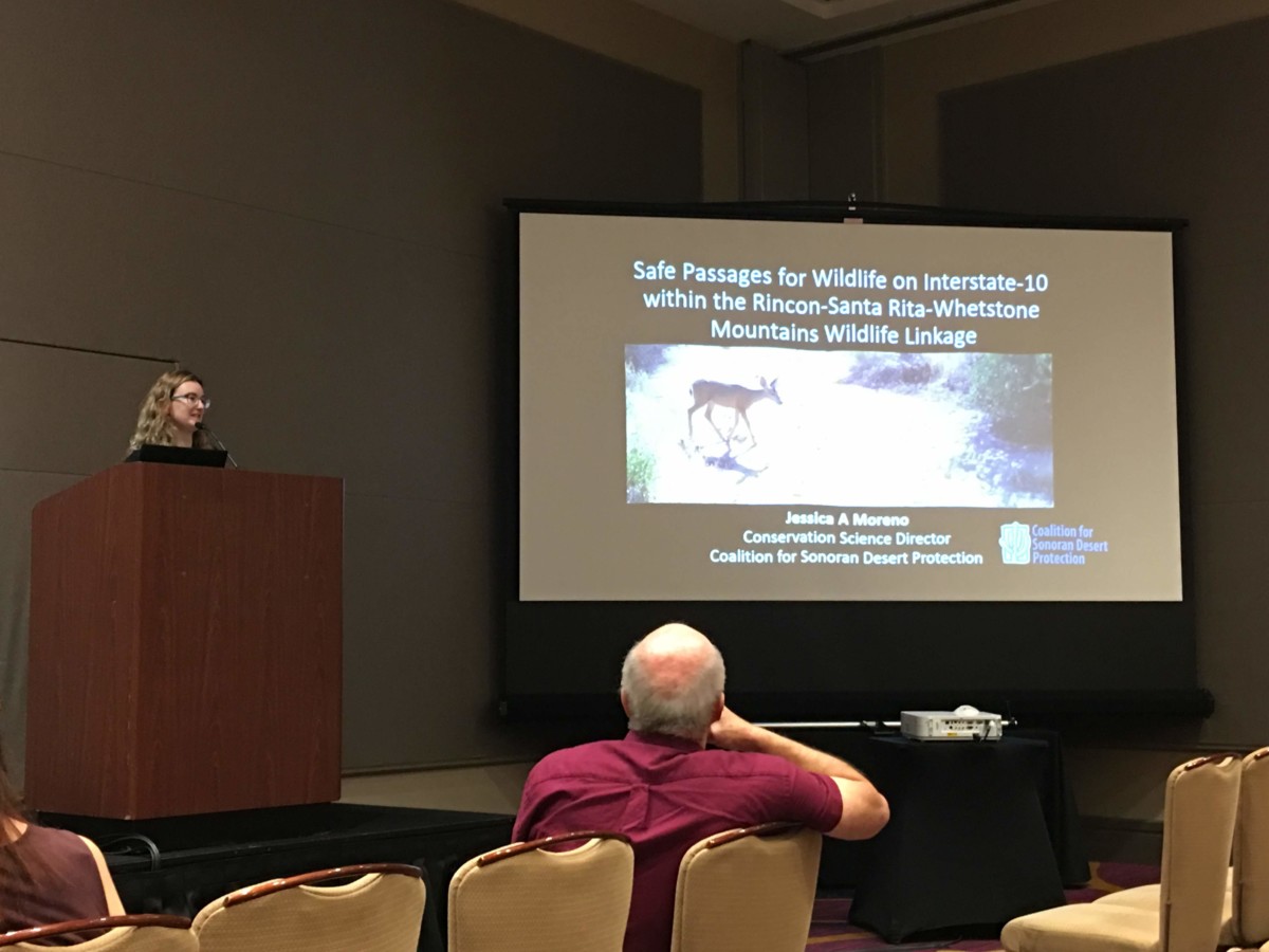
CSDP Conservation Science Director Jessica Moreno presents on the Coalition’s new I-10 Safe Passages project, funded by the Arizona Game and Fish Department Heritage Fund.