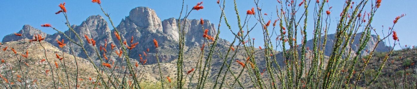
How are wildlife linkages located? How do we figure out the best places to locate wildlife crossings? What types of scientific research and data are used to make sure we are building the right types of crossings in the right places? Read more to find out!
Mapping Wildlife Linkages
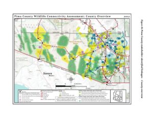
Mapping where wildlife move across the landscape can be done in many ways and each method uses science to model what we know. The tools have improved over time with new technology and new research. Post-construction wildlife monitoring of wildlife crossing structures continues to help refine what works best for different species. The Coalition has been involved in these planning processes since 1998, beginning with a focus on protecting habitat for the cactus ferruginous pygmy-owl and the development of the Maeveen Marie Behan Conservation Lands System and the award-winning Sonoran Desert Conservation Plan. Today, wildlife linkages have been modeled, mapped, and prioritized for conservation through several successive linkage designs, each building on the last. These maps are the culmination of many partners and stakeholders providing expertise and input. If you want to learn more about the extensive modeling, mapping, and scientific investigation that have been completed for Sonoran Desert wildlife linkages, the major efforts can be found below (click on the image to be directed to the report):
2001: Pima County’s Conservation Lands System Map and Guidelines, including Critical Landscape Connection (amended in 2005)
Designing Wildlife Crossings When it comes to helping animals cross the road, both science and engineering come into play. With wildlife linkage designs, roadkill hotspot studies, and wildlife-vehicle collision data, we can pinpoint the best places to build wildlife crossings. In this way, the wildlife tells us where they need to cross the highway. Each structure, whether a culvert, underpasses, or bridge or overpass, is specially designed for the species that needs to use it. In the Sonoran Desert, bighorn sheep and deer prefer bridges with a clear field of view, while javelina and bobcats tend to prefer underpasses, and skunks and badgers may be happy to use a small round culvert. In addition, specially designed wildlife fencing is important to ensure that the crossings are effective, by funneling animals right to them. Jump-outs provide escape ramps for any wildlife that do manage to get onto the highway. The cost of building these crossings is reduced by taking advantage of scheduled road-widening and improvement projects, so construction can occur at the same time. Ultimately, the investment in building wildlife crossings pays for itself in just a few years, with the reduction of wildlife-vehicle collisions and accidents that lead to human injury, loss of life, vehicle damages, and related emergency services.
FUNNEL-FENCING IN ACTION
The Arizona Game of Fish Department conducted a study in northern Arizona at the Munds Canyon underpass and Woods Canyon underpass on Interstate 17 in 2007. They found that elk did cross I-17 safely using the existing underpasses but vehicles still hit elk more than 20 times a year. After wildlife funnel-fencing was installed in 2010, however, wildlife-vehicle collisions with elk reduced to 0 or 1 per year – and there have been no elk collisions since 2013. Wildlife crossings on their own will work, but funnel-fencing makes them work best.
Here are some examples of wildlife crossings from around the world:
Photo credits for above gallery: Crab Bridge – Kristy Faulker ** Wildlife Bridge, Belgium – michielap ** Turtle Tunnel, Japan – samusai ** Wildlife Bridge, Banff National Park – Joel Sartore ** Wildlife Bridge, Singapore – cheekyasian ** Elephant Underpass, Kenya – AP ** Wildlife Bridge, North Brabant Province, The Netherlands – Obiektyw1855 ** Wildlife Bridge, Duinpoort, The Netherlands – Ambamja