On Monday, February 23, 2026, the Town of Sahuarita voted to approve its draft 2025 General Plan, a set of guiding policies for the management and future growth of the Town over the next 10 years.
CSDP worked with the Town to make two important updates to this plan:
- Sahuarita now joins the City of Tucson and the Town of Oro Valley in working alongside Pima County to deliver on regional conservation planning via the Conservation Lands System, part of the county’s Sonoran Desert Conservation Plan.
- Sahuarita’s opposition to any ‘West Option’ routes selected for the Interstate 11 project is now formalized in the town’s general plan.
Much gratitude for the two CSDP supporters and Sahuarita residents who wrote a comment or spoke at the Town Council meeting!
Background
The Town of Sahuarita sits just northwest of two regional wildlife corridors: the first across Interstate 10 at Cienega Creek, and the second which crosses Interstate 19 and the Santa Cruz River in southern Pima County (respectfully, “3” and “4” in the map below).
Sahuarita hopes to expand via annexation — and by a lot. The dashed line in the map below shows the areas into which the Town expects to expand within the next ten years. This area is known as Sahuarita East.
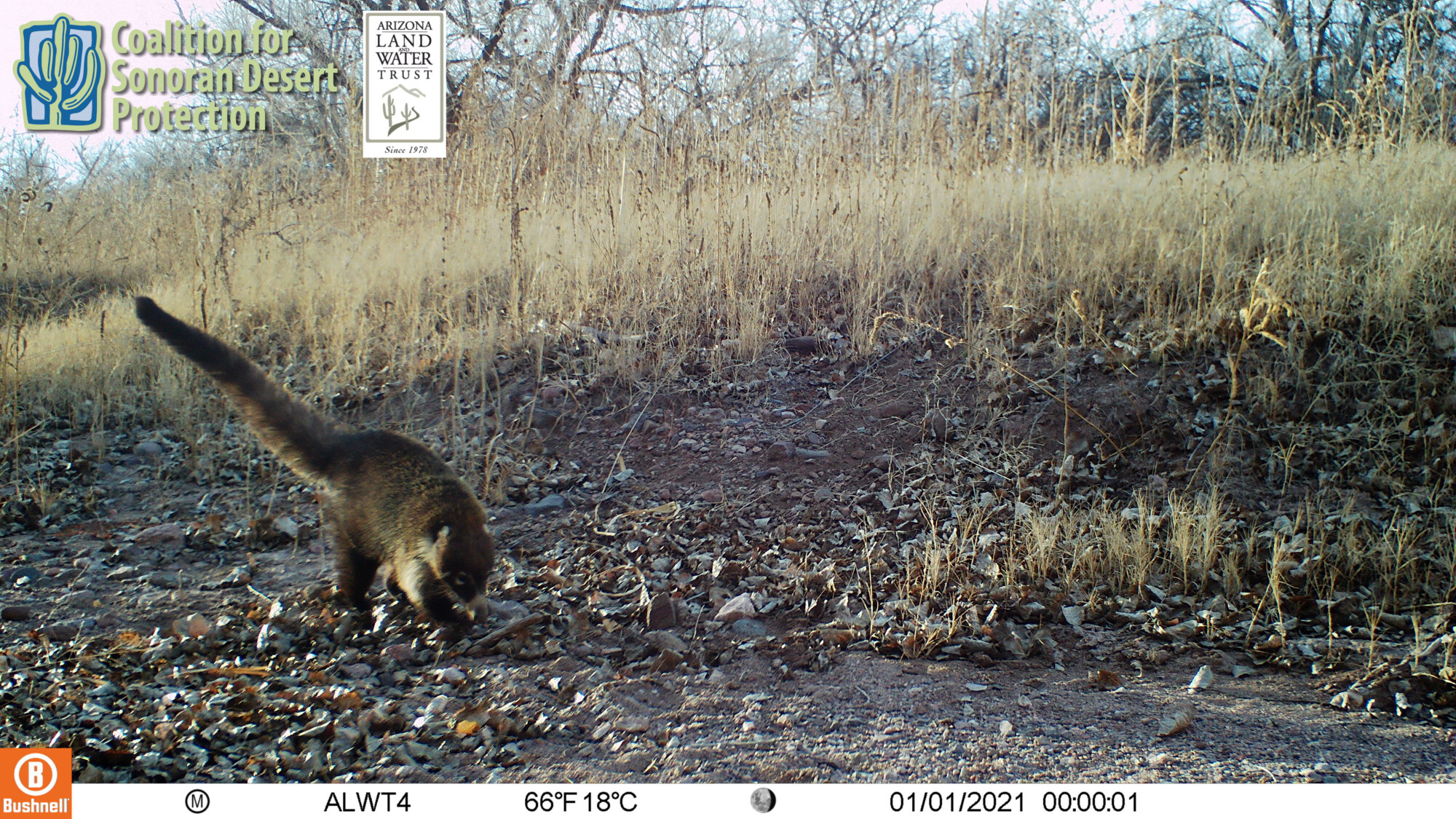
Our cameras from our Sopori Creek project area show just how much wildlife moves through this area, where washes flow to the Santa Cruz River from the Santa Rita Mountains, which include the Coronado National Forest and the Santa Rita Experimental Range.

By protecting sensitive habitat in Sahuarita East, Sahuarita will also protect the health of the Santa Cruz River — a focal point of the Town and projects such as the Santa Cruz River Urban National Wildlife Refuge.

Conservation Lands System map courtesy Pima County, with additions by the Coalition for Sonoran Desert Protection.
Not to scale.

Win #1: strengthened conservation planning
As part of the general plan update, we asked Sahuarita to bring existing conservation plans along with any land they annex into the Town. That would mean adopting Pima County’s award-winning conservation policy guidelines, known as the Conservation Lands System or CLS, into Sahuarita.
Our original ask was for Sahuarita to “apply” CLS guidelines when they annex land into Sahuarita. They ultimately agreed to “consider” the CLS guidelines, formalized as a new policy in the plan, “ENV-1.8: In post-annexation entitlement reviews, consider Pima County Conservation Lands System map and guidelines to balance new development with natural resource protection.”
It’s a good start.
WHAT IS THE CLS?
The Conservation Lands System is a planning tool implemented by Pima County’s comprehensive plan, Pima Prospers 2025. It is a well-established, flexible planning tool that applies only at rezoning and variance, that does not affect existing zoning, and that is already familiar to developers and other jurisdictions throughout Pima County. We helped to create the CLS as part of the Sonoran Desert Conservation Plan. The CLS identifies habitats of high biological value and wildlife corridors in our region.
WHY IS THIS IMPORTANT?
In Sahuarita East, areas mapped under the CLS concentrate around land already subject to the Town’s Regulated Riparian Habitat (RRH) requirements and standards. While the RRH seeks to provide parcel-by-parcel protections, the CLS allows for a holistic approach to connectivity — ensuring that at least some natural space is continuously maintained in key areas where wildlife and our other Sonoran Desert species can move around us.
Win #2: Sahuarita opposes Interstate 11’s West Option
Thanks to fantastic Sahuarita resident Jan McClellan, who spoke at the general plan’s public hearing, and CSDP’s further encouragement, the general plan was updated minutes before the final vote to reflect the Town’s opposition to the Interstate 11’s “West Option” through Avra Valley.
The plan’s original language spoke positively of Interstate 11, so this was an important update.
You can read more on the Town’s opposition in their 2021 letter below.